

Netherwitton Parish
Netherwitton parish is located in Northumberland, England, approximately 8 miles northwest of Morpeth, covering a rural area along the River Font. Historically and traditionally, the parish and its chapelry include the village of Netherwitton and several surrounding townships: Coat Yards, Ewesley, Healy with Comb Hill, Nunnykirk, Ritton Colt Park, and Ritton White House.
- Geography: Situated in a rich vale, the parish covers an area of roughly 7,723 acres.
- Key Landmarks: The area includes Netherwitton Hall, a Grade I listed building owned by the Trevelyan family, and St Giles Church.
- Administration: It is managed by the Netherwitton Parish Council, which meets in the local village hall.
- Boundaries: It is bounded by the parishes of Rothbury, Long Horsley, and Hartburn.
Stanton
STANTON, a township, in the parish of Long Horsley, union, and W. division of the ward, of Morpeth, N. division of Northumberland, 6 miles (N.W. by W.) from Morpeth; containing 128 inhabitants. This place, from the discovery of numerous foundations of buildings in the immediate vicinity, appears to have been formerly of greater extent and importance. Among the earlier proprietors were the Merlays, Corbets, Mitfords, and Fenwicks. The ancient manor-house, the seat of the last-named family, has been converted into a house for the reception of the poor; and a chapel which stood a little to the north of it, has altogether disappeared. The township comprises about 1875 acres of land, divided into several farms; the surrounding scenery is pleasingly varied, and from an eminence on the north bank of the Font is a beautiful prospect over the valley of Witton-by-the-Waters, and the woods of Langshaws and Nunriding. The substratum contains coal and limestone; a colliery is in operation, and there are several quarries of limestone, and kilns for burning it into lime.
Stanton is in the parliamentary constituency of Berwick-upon-Tweed. Stanton was formerly a township in Long Horsley parish, from 1866 Stanton was a civil parish in its own right until it was abolished on 1 April 1955 and merged with Netherwitton. (Wikipedia)
Ewesly
Ewesley, a township in Nether Witton parish, Northumberland, on the river Font, 5½ miles S of Rothbury, with a station on the Rothbury and Scots Gap branch of the N.B.R. Acreage, 946; population, 21.
Transcribed from The Comprehensive Gazetteer of England & Wales, 1894-5
Ewesley station was a weather board and corrugated iron built railway station in Northumberland on the Rothbury Branch built to serve the local farming settlements.
One of the original stations on the branch line Ewesley was constructed in the centre of a circular prehistoric camp.[3] Later in 1894 the only passing loop on the otherwise single track line was constructed at Ewesley. At closure the station had been renamed Ewesley Halt. Although in a bad state of repair the platform remains intact, the station building has been demolished.
Healy with Comb Hill
Nunnykirk
Nunnykirk is a settlement and civil parish in the county of Northumberland, England. In 2011 the parish had a population of 160.
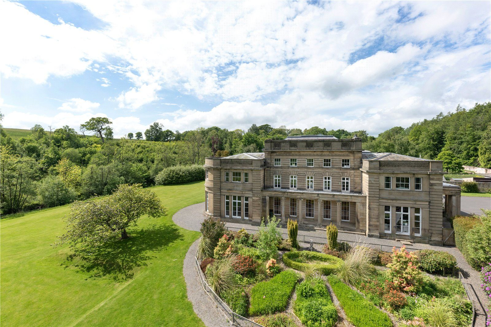
Nunnykirk is the location of Nunnykirk Hall, a former nunnery country house and current school.
Nunnykirk was formerly a township in Nether Witton parish, in 1866 Nunnykirk became a civil parish in its own right, on 1 April 1955 the parishes of Coatyards, Ewesley, Healey and Combhill, Ritton Colt Park, Ritton White House, Todburn and Wingates were abolished and merged with Nunnykirk.
(Photo source: Zoopla)
Ritton Colt Park
Ritton White House
RITTON-WHITEHOUSE, a township, in the parochial chapelry of Nether Witton, union of Rothbury, W. division of Morpeth ward, N. division of Northumberland, 5¾ miles (S.) from Rothbury; containing 26 inhabitants. In 1663, Ritton-Whitehouse and Roughlees are stated to be the property of Sir Thomas Riddell, of Cheeseburn Grange; after which, a family named Forster held the estates; and subsequently, the Kerrs and the Trevelyans came into possession. The township comprises about 616 acres, and consists of three farms. The land is high, and much exposed to the winter blast from the hills to the north and west.